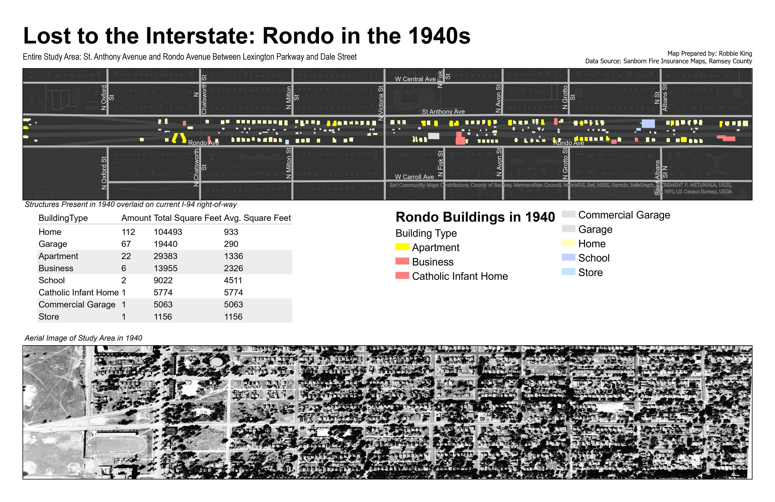
Lost to the Interstate: Rondo in the 1940s
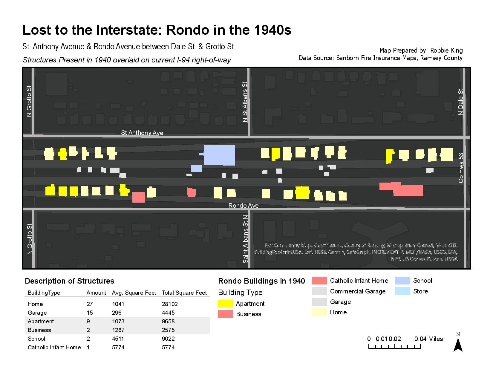
Beginning in 1956, homes, schools, apartments, businesses, and stores that made up the Rondo neighborhood were demolished to make way for Interstate 94. Prior to the demolishing of Rondo, planners had the option to route I-94 along existing rail right-of-way that was not in use just to the north of Rondo. The fact that planners continued with the Rondo alignment underscores the undeniable fact that planners valued mobility and access to the city for suburban residents, who are predominately white, over the community, property, and livelihoods of Black residents.
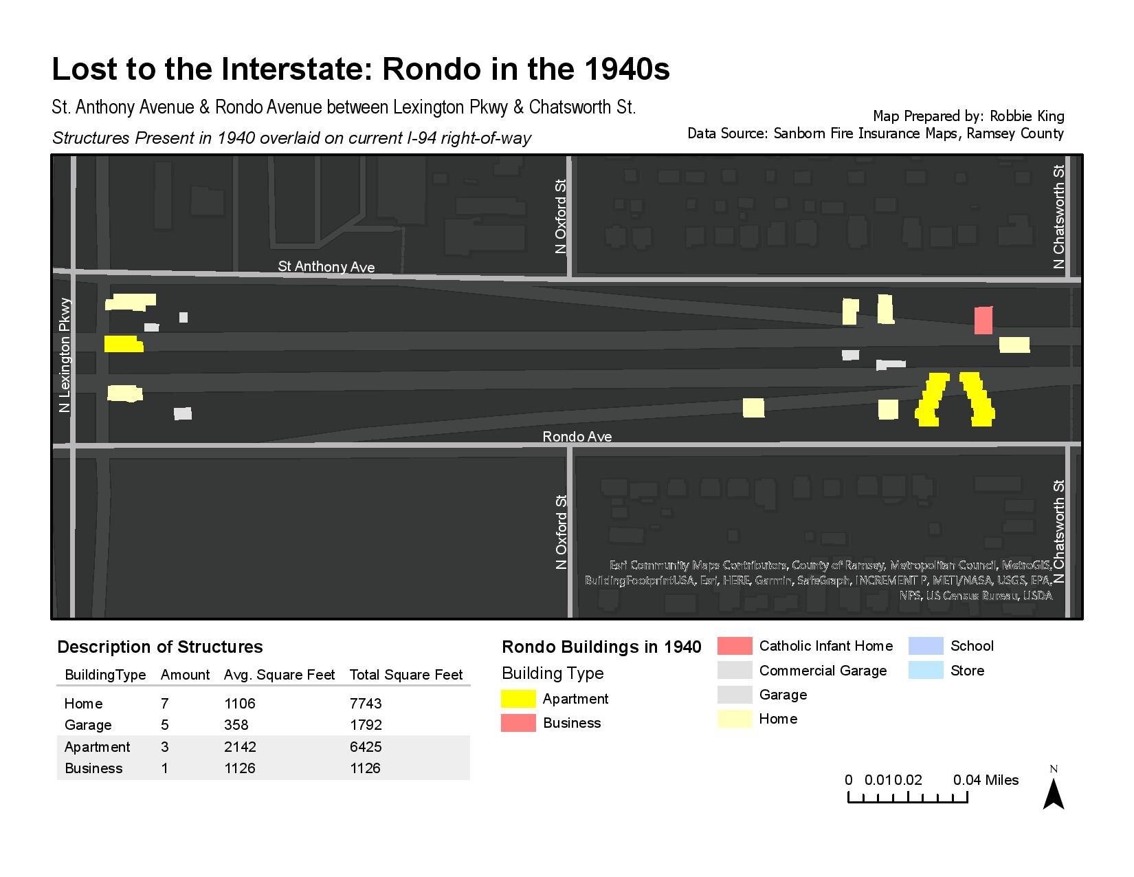
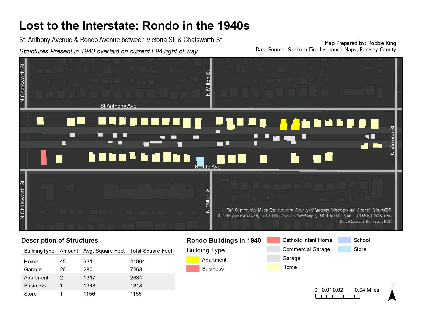
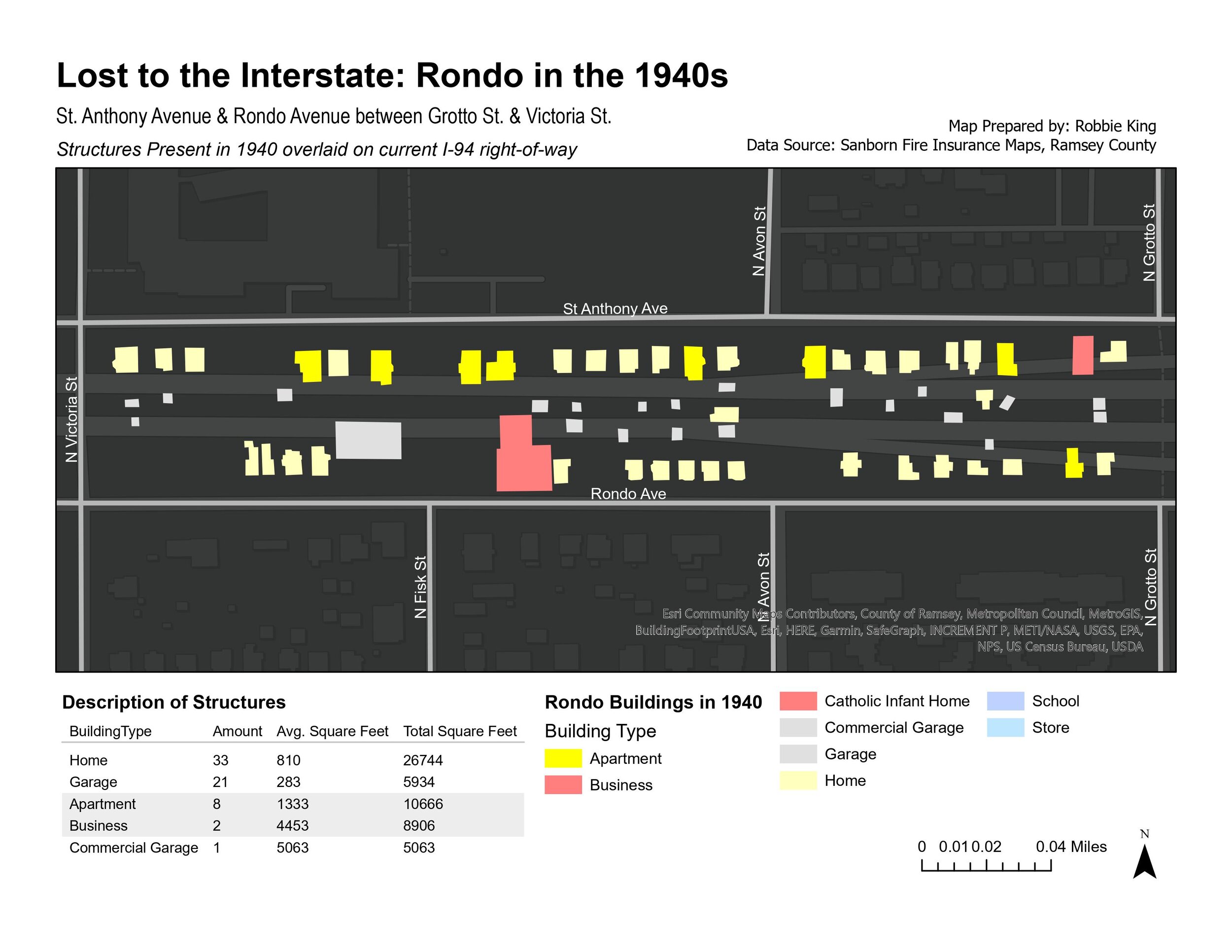
This project aims to quantify buildings that were demolished to build I-94. I digitized Sanborn Fire Insurance Maps from the 1940s into ArcGIS and then classified the structures according to what was there in 1940. Granted, there were changes between 1940 and 1956 in Rondo that is not captured here.
Now that you’ve seen what was once there, you have a chance to see what is there now and imagine how it could be different. Go and stand on Rondo Avenue (now Concordia Avenue) and observe the wall of infrastructure that now occupies where these structures used to be.
Reconnect Rondo has a vision to bring down that wall of infrastructure and stitch back together the community that had once stood. I am strong believer in the work they are doing and we should all closely follow news about the Rondo Land Bridge!